Introduction
The New Deal, an initiative made by President Franklin Roosevelt to bring the US out of poverty gave rise to many “resettlement communities.” These were large areas purchased for the purpose of creating agricultural or industrial neighborhoods where forlorn workers were given a fresh start in the form of a home, property to manage and businesses to take part in. These communities were inspired by the colonization of Australia through a similar system and were driven by a growing back-to-the-land movement sparked by a country rapidly industrializing. Elwood Mead; an American Civil Engineer and irrigation expert famous for planning projects such as the Hoover Dam had been working in Australia as its colonization was underway and observed and advised as the Australian government irrigated, developed and then moved populations to farmland where they were expected to give a part of profit as a return. These projects were successful, and Mead was so impressed that he returned to the states and suggested the creation of some of these communities, eventually resulting in the founding of the first resettlement communities in the US. Although these pre-New Deal resettlement communities did not make financial returns, Mead’s ideas were nonetheless passed on to FDR, who implemented them once again as part of the New Deal. Arthurdale was the first of these new communities, and is one of many that have origins and features that distinguish them as a relevant part of the United States’ history. This series will highlight some of the other resettlement communities, their past, and how they are today.
Elwood Mead and his Durham Colony
Prior to the large New Deal movement, there were several resettlement communities created, some for struggling workers and others for returning WW1 veterans. It is important to mention these first communities, as they would impact the opinions of the public and politicians alike and affect decision making as the New Deal progressed. The first of these was Durham, located in Butte county, California. After much debate, Elwood Mead convinced California legislators to invest in an early resettlement community, arguing that they would have more control in the goings on in such a community than the failed irrigation projects that had been plaguing the state. Mead’s core ideas included extensive planning by agricultural experts, cooperative institutions, and the presence of resident agricultural advisors overseeing farm work. Durham was constructed in 1917 and settlers were hand-picked by Mead and a committee, given 110 acres of land, a choice of a few models of impressively modern homes and the task of managing their land diligently. They were to remain on it 8 months of each year for ten years. Durham was successful at first, but it soon fell victim to the depression. This resulted in a large loss for the Californian government as the residents of the two communities fell behind on work and land payments. Despite these failures, Mead continued to push his ideas, moving to Washington and gaining a nationwide audience through the connections he made there. Mead thrived, but failed to get another resettlement community off the ground. After his election, Franklin Roosevelt created his “Brain Trust”, a group of hand-picked advisors; which included Rexford Tugwell, an admirer of Mead. Tugwell was a planning specialist and firmly believed in Mead’s ideas. He was selected as the head of the Resettlement Administration: which would eventually construct Arthurdale. Tugwell was often labeled as a communist sympathizer throughout his long political career, even being ousted from Roosevelt’s group of advisors after trying to pass several bills that were deemed unconstitutional for the times. His involvement as well as the financial shortcomings of preceding communities contributed to the controversy of Arthurdale, which was already criticized for its use of tax dollars to provide comparatively luxurious conditions for its homesteaders in a time of financial crisis. Projects like Arthurdale would continue to receive backlash and strong resistance from members of the government for their duration, and it is important to note this when reading about resettlement communities and their stories.
Cumberland Homesteads
Located in Cumberland County, Tennessee, Cumberland Homesteads has similar origins to Arthurdale–jobless and neglected coal miners and other workers were screened for agricultural knowledge and moral character. Those that were selected were settled into government-provided homes and were given co-op businesses to run and land to farm. Cumberland Homesteads is distinguished from other New Deal communities by its distinct and beautiful architecture and the unique stone that was used to construct its buildings. Called “Crab Orchard,” this stone is known for shining with a red hue in sunlight and is the main material used for the majority of the original buildings. Tennessee architect William Macy Stanton designed the structures and layout of the town, which spanned over 10,000 acres at its conception. It features picturesque landmarks such as the Administration Tower, multiple Crab Orchard bridges, and an original home now converted into an exhibit. The Administration Tower gets its name from the water tower constructed at its center with an unusual cross shaped base. It now is home to the Cumberland Homesteads Museum. Cumberland Homesteads is now part of the National Registry and houses Cumberland Mountain State Park, where many of its landmarks can be found.
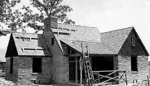
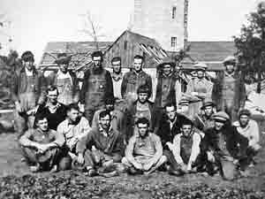
Visit them at https://cumberlandhomesteads.org/
Aberdeen Gardens
Aberdeen Gardens, located in Hampton, Virginia, was the first of 11 New Deal communities designed by and for the sole benefit of African Americans who struggled during the Depression. Constructed with funding and planned by Hampton University–a historically black private school–and designed by African American architect Hillyard R. Robinson, Aberdeen Gardens consisted of 158 homes and an elementary school all of which were constructed by black laborers. These houses were made of brick, double-layered to protect against fire- and sat on ½ acre plots over 7 streets, each of which were named for prominent African Americans, save Aberdeen Road. All homes had indoor plumbing, were heated and featured garages–uncommon for the time. Aberdeen gets the “Gardens” half of its name from the large and prominent gardens in the yards of each home where community members would grow their own food and herbs as well as a house-specific varieties they would provide to the cooperative general store, ensuring it had a larger selection of products. Today, Aberdeen Gardens is a Virginia Landmark, is listed on the National Register of Historic Places, and has its own museum housed in one of its original homes.
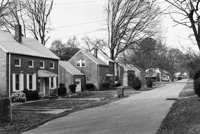
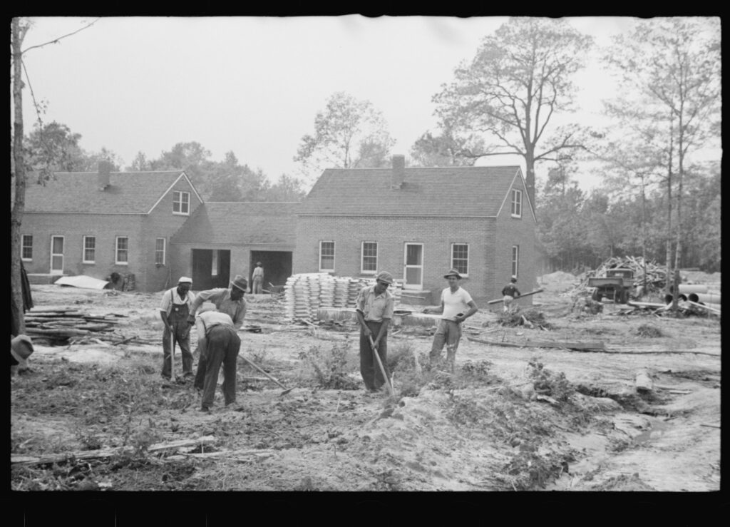
Find them at https://visithampton.com/attraction/aberdeen-gardens-historic-museum/
Dyess
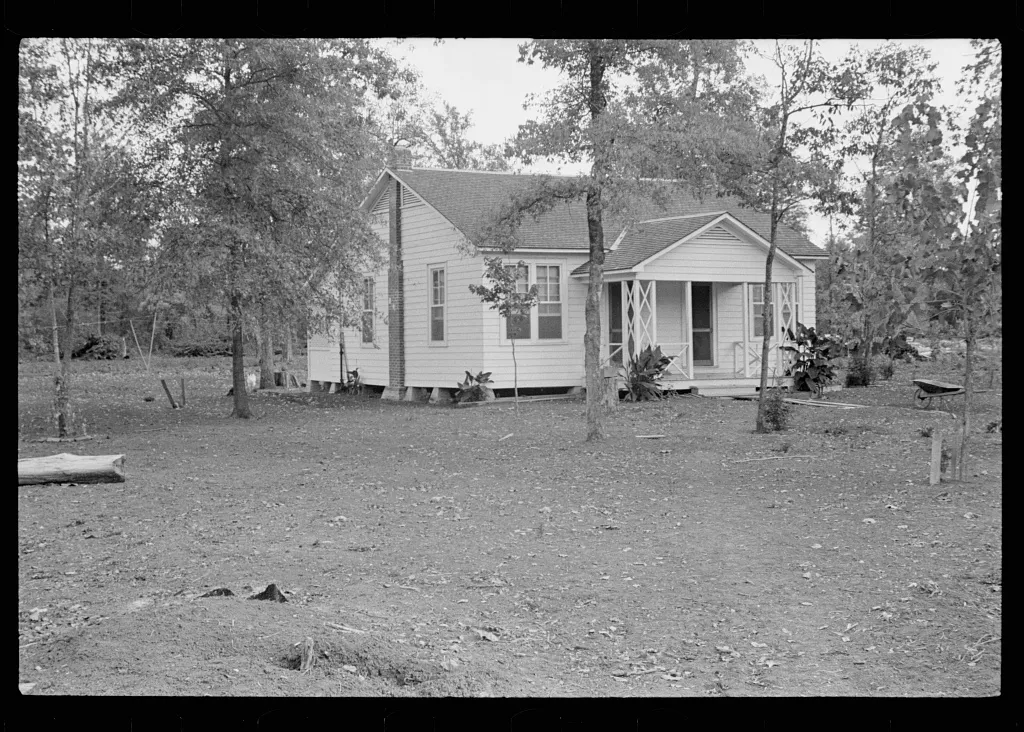
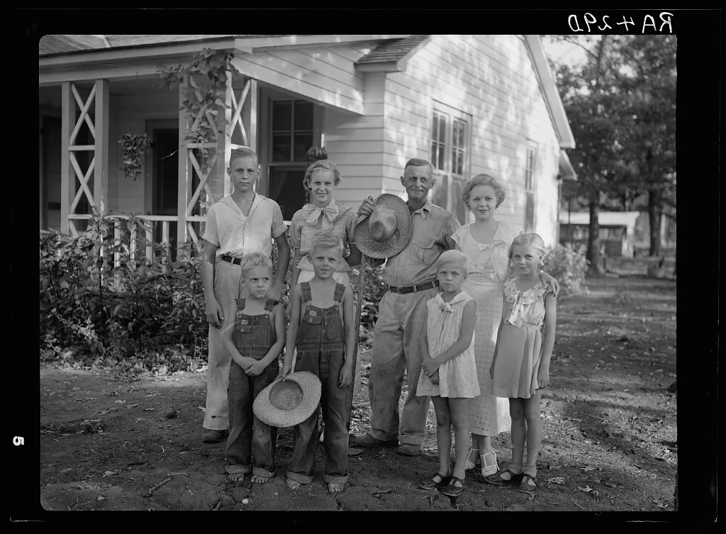
Dyess was started by and named for cotton farmer and politician William Dyess who was the head of the Arkansas Emergency Relief Administration, which aimed to establish a resettlement community in Arkansas on nearly 16,000 acres of land. Dyess was an ambitious project, using the most land and housing one of the largest amounts of people of any New Deal town. Dyess residents were given 20–40-acre strips of land to farm and were composed of down-on-their-luck Arkansas sharecroppers. The homes were small–having 4-5 rooms, and the design varied from one to another to avoid making them all too alike. William Dyess personally ran the town until his death in 1936, when changed hands to Floyd Sharp. Sharp’s political enemy and the current governor, Carl Bailey, attempted to dissolve the town by convincing them to incorporate. Mismanagement of fees associated with the incorporation led to punitive action against the town, which was saved by moving assets from Dyess Colony Incorporated to the newly established Dyess Rural Rehabilitation Corporation, ending the towns’ legal struggles. Dyess is also notably the birthplace of singer Johnny Cash, who wrote songs like “Pickin Time” reflecting on his childhood in Dyess. Dyess preserved Cash’s home along with other historical buildings such as the Dyess Colony Visitors Center, located in the original administration building.
Find them at https://dyesscash.astate.edu/visit/
Matanuska Valley
Alaska’s Matanuska Valley stands out among other resettlement communities in a variety of ways, most notably the vast distance the colonists were moved. For most communities, colonists were transferred locally or not more than a state over. With rising tensions between countries and a growingly expansionist Japan threatening Alaska, the government saw fit to establish an agricultural colony there to feed a potential military base as well as to bolster its dwindling population and economy. Matanuska Valley was already known to be fertile from previous surveys- and due to its supposedly similar climate to Wisconsin, Michigan and Minnesota, farmers from those northern states were screened, selected and shipped thousands of miles to Alaska. Since there was much opposition towards New Deal projects at the time, this trip was used as an opportunity to produce positive press and propaganda. This came in the form of painting these colonists as adventuring pioneers, setting out to uncharted territory with intentions to tame the land. The press went so far as to inspire a play, “200 Were Chosen”, which detailed the journey and arrival of the colonists in a desolate and difficult land, and their remaining resolute in the face of its challenges. In reality, the valley had long been known to be habitable: having been occupied by the native Dena ’Ina people. Arriving in the valley, settlers were greeted by a large field with dirt roads lined by large tents, meant to be temporary homes while transient workers finished their permanent abodes. All of this was walled in on three sides by towering, picturesque mountains that kept both storms and the worst of the cold Alaska weather out of the valley. Unfortunately for many colonists, these homes would not be completed before the freezing fall, and many would leave due to sickness or exposure before the town was made operable in 1936. Further issues came in the form of a lack of farming experience both in general and in the conditions of the valley. As a result, 124 families were asked to leave or left during the first season and were gradually replaced over the next 5 years. Once the colony was on its feet, a great need for agriculture in the area caused by the construction of a military base nearby allowed the farms of Matanuska Valley to thrive and continue to thrive to the present day. Matanuska Valley is home to an original colony house open to tours, a national park and is known for growing record-setting vegetables, notably a 138-lb cabbage that holds the record for largest to this day.
Find them at https://www.alaskavisit.com/things-to-do/museums/
Estate Whim
The U.S.’s virgin Islands house at minimum 21 homestead communities constructed after the crashing of the sugar industry due to the depression, which rendered thousands of acres of plantation land unused. This land was then bought up by the US government and divided amongst Puerto Rican immigrants and struggling locals to be used as small, 6-acre homesteads. The sugar industry had lasted on the islands for centuries, with some plantations dating back to the early 1700s. The island of St. Croix is speckled with the ruins of windmills, animal mills and ruined, extravagant homes that held the land’s bygone owners. One such plantation is Estate Whim, which has restored many of the historical buildings, including the windmill, great house, watchmen’s hovel and several plantation mechanisms. The estate was established by Danish East India and Guinea company who, from 1734 to 1760 wrested economic control of the island from the British colonists living there. The Danes made use of slaves to run their plantations, and continued to do so for 40 years after the Danish crown outlawed it- only stopping after riots pressured the governor into freeing the island’s slaves. During this time the Napoleonic wars put the Danes at odds with the British, leading to the island changing hands many times, and in the coming century several natural disasters hit and ravaged the plantations. This led to the drastic decline and then ceasing of the sugar trade on the islands. Due to this, the Danes sold the islands to the United States in 1914, whose government bought much of the still occupied land in the 1920s from their owners for federal use, including Estate Whim. During the plantation’s 15 year stint as homesteads, the 850 acres of farmable land was heavily divided, which solved the long-running land distribution problems on the island, but the homesteaders continued to struggle with poverty in spite of the government’s efforts.
Find them at https://www.heritage.vi/whim/
California’s Migrant Labor Camps
While not a traditional homestead, migrant camps were nonetheless handled by the same government bodies that created homesteading communities and are a part of the New Deal’s history. The 1930s saw a large group of struggling peoples move from the Midwest and east coast towards California in search of land and opportunities. Driven by the depression and the Dust Bowl, these people, labeled “Okies” due to many being from Oklahoma, arrived in droves to a state that didn’t have the infrastructure to house or employ them. The few jobs available were highly competitive and natives were often hostile to newcomers, leading to many living in shanties along creeks, some of which would die of exposure, hunger or disease. Eventually, the government took action, designating areas for the migrants to camp and pitching large tents or tin cabins as well as shared facilities. One camp, called “Weedpatch Camp”, still has some of the original facilities today, and even still holds migrant workers. It is also the camp featured in John Steinbeck’s “The Grapes of Wrath”.
Find them at https://dustbowlcamp.org/

